Taking a Closer Look: Drone Surveys Help to Understand Sanctuary Beaches

The way a beach looks one year may be totally different from how it looks another. Although it may be hard to notice, our beaches are constantly shapeshifting. Multiple natural processes work in tandem to contribute to a dynamic coastline. Waves and rivers erode and transport beach sediments out to sea while ocean currents move these sediments up and down the coast throughout the year.
Generally speaking, beaches are at their widest during the summer months when ocean conditions are calm. In the winter, beaches shrink after powerful winter storms bring large swells that erode them.
Dr. Wendy Kordesch, Geological Oceanographer with Greater Farallones Association and a NOAA Affiliate to Greater Farallones and Cordell Bank National Marine Sanctuaries, is working to understand how select beaches along Greater Farallones National Marine Sanctuary and Monterey Bay National Marine Sanctuary evolve over time due to these processes, paying special attention to how they are changing from season to season.
How is she doing this? Drones!
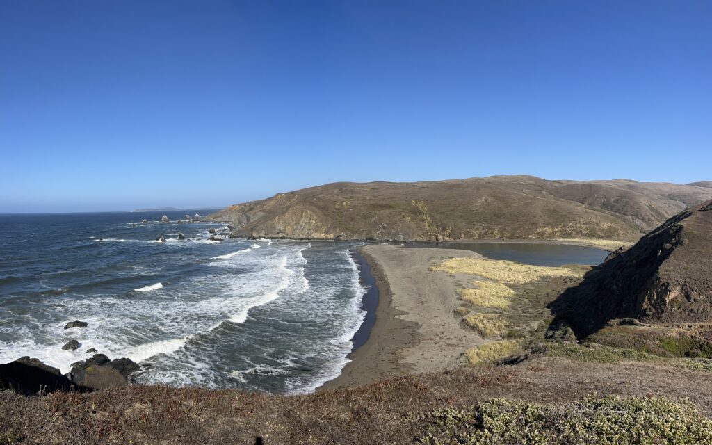
Estero de San Antonio along the Greater Farallones National Marine Sanctuary coastline.
As part of a project funded by NOAA’s National Centers For Coastal Ocean Science, Effects of Sea Level Rise Program, Dr. Kordesch is working with partners from Greater Farallones and Cordell Bank National Marine Sanctuaries, the U.S. Geological Survey, and Oceans Unmanned to conduct drone surveys along the sanctuaries’ coastlines. Twice a year, with the proper permits in hand, the team flies drones high above sanctuary waters to capture high-quality imagery that details how a beach has changed following the winter storm season and how it has recovered later in the year.
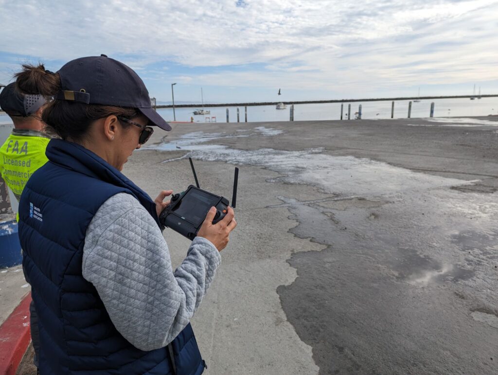
Dr. Wendy Kordesch operates a drone to capture imagery of the coastline.
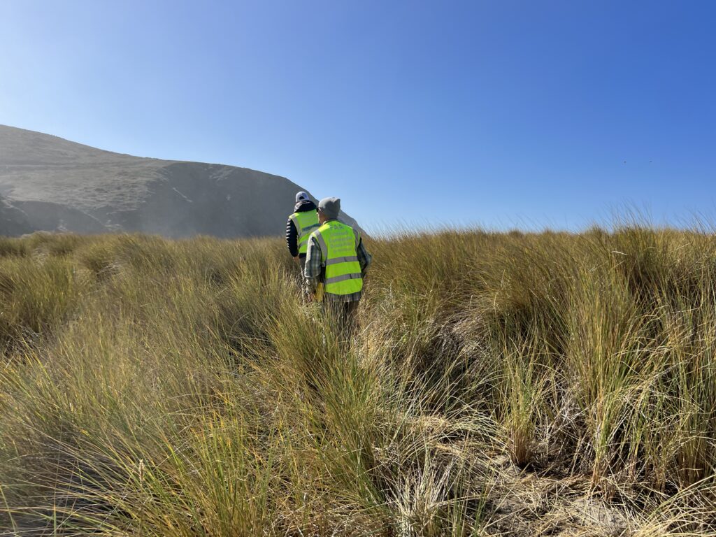
The Oceans Unmanned team hikes into the survey site at Estero De San Antonio.
Once enough of this data is collected, the team will attempt to predict what these same beaches will look like over a long period of time using scientific computer modeling.
By understanding what the coastline might look like in the future, coastal communities and natural resource managers can make science-based decisions on how to plan for climate change-related sea level rise which threatens wildlife habitat adjacent to the sanctuaries.
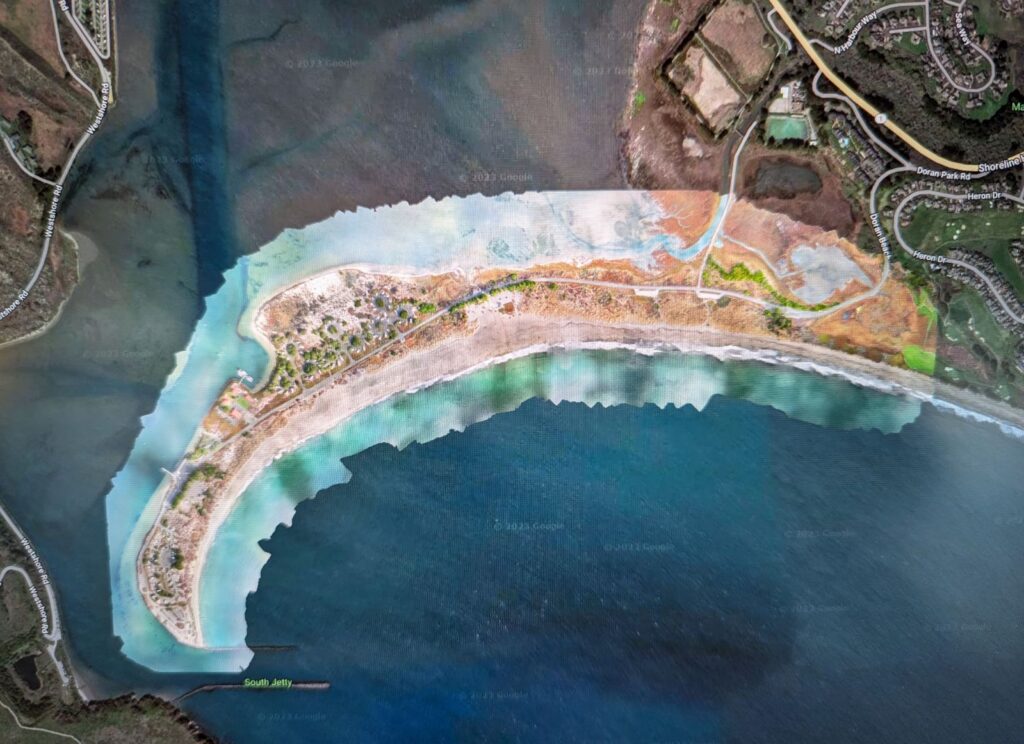
Example of imagery produced by drone surveys. Seen here is Doran Beach in Sonoma County.
Please note that flying drones is not allowed within national parks and certain areas within national marine sanctuaries without proper permits. State and local parks also regulate drone flights, so if you are planning on flying a drone along the coast, please ensure you are in compliance with regulations.